|
Research and Innovation
Information Technology system for Surveillance and Monitoring of Water Quality in Real-time, Palian Basin, Trang Province
June 6, 2022
Indicator 14.3.4
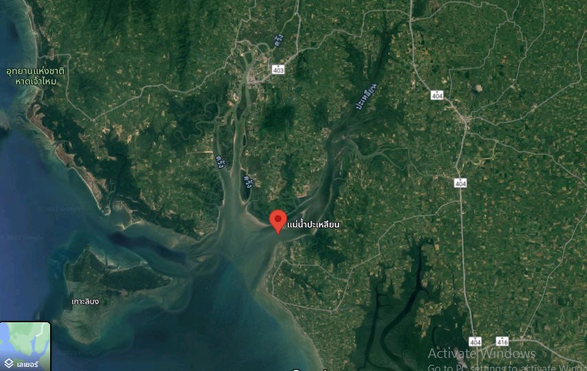
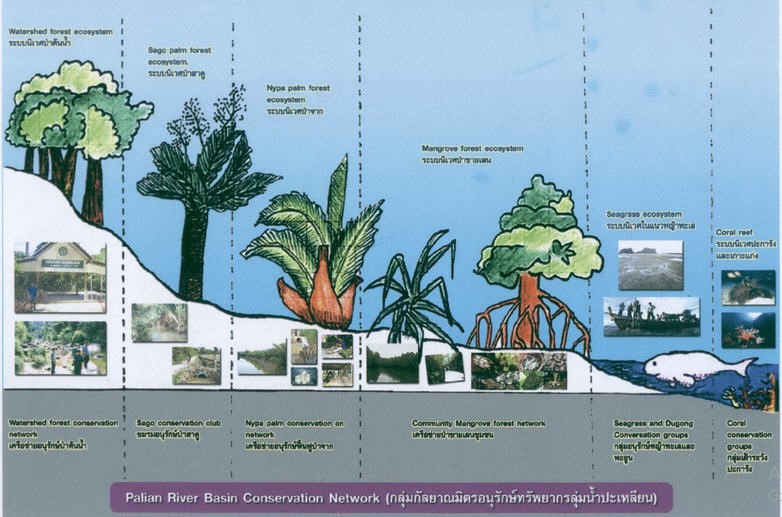
Palian Basin originates in the Banthat Mountain Range in the provinces of Phatthalung and Satun. It is 58 kilometers long and has seven major streams, which flow through three districts (Yan Ta Khao, Palian, and Kan Tang) in Trang Province to the Andaman Sea at the Palian River's estuary in Palian and Kan Tang districts. As a result, the Palian Basin was established as the community center for Ban Wang Won in Kan Tang District, Ban Thung Kabue and Ban Thung Khai in Yan Ta Khao District, and Ban Na in Palian District. According to the flow of the streams, these areas are rich in biodiversity of natural resources, particularly mangrove forests, becoming animal habitats and nurseries for young and local marine animals. Furthermore, some jobs in the communities were created, including fishing, farming, community product processing, and tourism.
Sources: https://www.google.co.th/maps/place/
Sources: https://yadfonfoundation.files.wordpress.com
Rajamangala University of Technology Srivijaya (RUTS) is committed to monitoring water quality in real-time monitoring for decreasing the risk and the loss of aquatic products for coastal aquaculture farmers through RUTS research and innovation. Mr. Nikom Onsri and his research team was working on the research and action with the title is “Information Technology System for Surveillance and Monitoring of Water Quality in Real-Time, Palian Basin, Trang Province”.
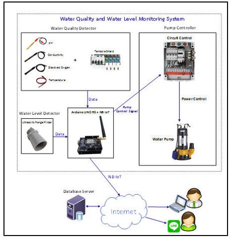
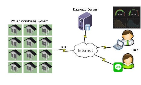
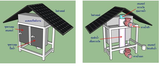
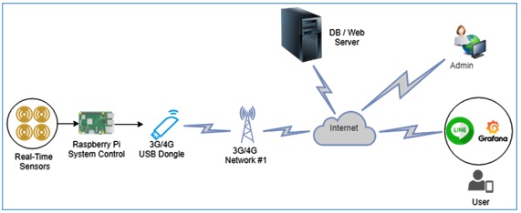
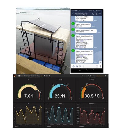
The impact of climate change on the quality of natural water resources was considered to predict the retention rate of necessary marine animal resources and to be conservation guidelines and sustainable management in aquatic animal resources. The design of information technology for surveillance, monitoring, warning, and real-time water quality verify to decrease the risk and the loss of aquatic products for sustainable coastal aquaculture farmers. It can determine long-term solutions and prevention and find the guidelines to encourage culture aquatic farmer also enable to plane to solve the environment issue that changes from the special situation such as water flooding, west water, overload freshwater, and drought, etc. This research and innovation is monitoring and surveillance the quality of the environment in natural water resources to culture aquatic animals in coastal areas. This innovation applies measurement sensors to compare four parameters like Dissolved Oxygen (DO), pH, salinity, and temperature. The water quality measurement sensors receive power from the solar PV power supply. This work can send a database to coastal aquaculture farmers via the application. It can warn using a decision color code, which transfers system status and water quality into a Line application every 30 minutes. Users can access the real-time and previous period.
This work is an early warning, easy accessing essential data to decision making while water quality issue. All information helps to make guidelines to prevent that possible practice in coastal aquaculture farming. However, this innovation encourages product quality and decreases obstacles to cultural aquatic farmers who live in the coastal areas to be secure and sustainable in their careers.
Related Links: http://trang.rmutsv.ac.th/trang/th/news/2415-1647426419-576-160322
https://www.facebook.com/photo/?fbid=4843267829100123&set=a.4595811010512474
https://thainews.prd.go.th/RegionNews/RegionNews/Detail/TCATG220316180545552
|
||||||